York Festival of Ideas

- News and events
- Events
- York Festival of Ideas
- 2014 festival
- Talks
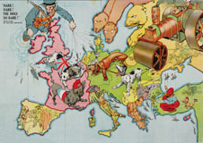
- Mapping the First World War
![]()
Mapping the First World War
Dr Peter Chasseaud, Historian of Military Cartography
- Wednesday 18 June 2014, 6.00PM to 7.00pm
- Free admission
Booking required - Ron Cooke Hub, University of York (map|getting to campus)
Event details
![]()
Thousands of millions of military maps were produced during the First World War, covering fronts from Belgium to Italy, from the Baltic to Rumania, from the Balkans to Gallipoli, and from Palestine and Iraq to Africa. Even more were produced for political and civilian purposes. The maps not only tell the story of the war, but reveal a great deal about strategic, imperial and colonial, political and military ambitions and operations, and about the state-of-the art aerial reconnaissance and intelligence organisations of the great powers. A relentless technological advance was taking place, embraced by forward-looking generals and staffs eager to break the deadlock: survey and mapping, embracing grids and orthomorphic projections, flash-spotting and sound-ranging, aerial photography and photogrammetry, by forming a crucial component of an integrated weapon system that enabled the artillery technique of predicted fire to restore surprise and mobility to the battlefield, became part of a revolution in military affairs.
Talk suitable from 14 years upwards
About the speaker:
Dr Peter Chasseaud is a historian of military cartography. For fifty years he has taken a keen interest in the First World War, his doctoral thesis taking the form of a comparative study of British, French and German survey and mapping in that conflict. He has written several books on the subject, notably the trench map atlas Topography of Armageddon; Artillery’s Astrologers: A History of British Survey and Mapping on the Western Front; Rats Alley on trench names, and Grasping Gallipoli: Terrain, Maps and Failure at the Dardanelles (with Peter Doyle), and selected and edited DVDs of trench maps from the collections of the Imperial War Museum and The National Archives. His latest book, Mapping the First World War, was published by HarperCollins in November 2013.
Accessibility
![]()
Wheelchair accessible
Tickets
You may also like...
This event is part of the The War That Changed Our World festival theme. Also in this theme:
Festival tweets
Tweets by @YorkFestofIdeas
University of York,
Heslington,
York,
YO10 5DD,
UK
|
yorkfestivalofideas@york.ac.uk
![]()
Legal statements | Privacy | Cookies | Accessibility
© University of York | Modify | Direct Edit